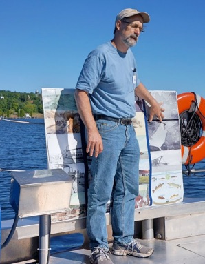
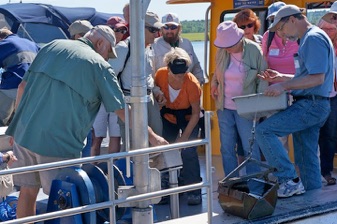
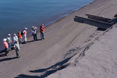
Lake Trip Details
 
Keweenaw Geoheritage Field/Boat Trips--
July 25, 2019

Copper Mining Waste of Lake Superior Today   
This trip is to see and understand the active processes of the lake today--the current geological setting and its physical oceanography. We will see active lake wave actions, currents, winds/dunes areas, numerous river mouths, deltas, beaches. Human induced environmental changes will be our strong focus. Mining waste situations such as Gay and Torch Lake Sands, will be visited and compared. Click on Green words below for more content.

What’s included:  Van and Boat transport and lunch. No overnight costs covered. Vans may be joined in Houghton one hour before the meeting time and transport back to Houghton from the end point each day is available to those who want/need it.


Visiting Expert:   Dr Casey Huckins Dr Carol MacLennan
8:30 am:  meet at Grand Traverse, visit sands at Breakwater. 
9:00 am:  Board Agassiz at Grand Traverse,  see sands from Keweenaw Bay, observe Buffalo Reef with underwater camera
11:00 am  Gay Sands.  Walk to shoreline of sands. (0.2 mi RT)
Dock at Dreamland. Drive to Gay
12 noon: Picnic Lunch at Tobacco River mouth (short walk).
1:30 pm: Board Agassiz at Dreamland. Observe Torch Lake Sands, Channel from Portage Lake to Quincy Mill 
3:30 - 5 pm: Disembark at Lake Linden Marina, visit Lake Linden Sands/ Traprock Delta, Hubbell Mill site (Osmose), slag fan, Tamarack stamp Mill, Quincy Dredge/Mason.


What to bring:  Several layers for wind and cold conditions, possible rain? But it could be warm also! Strong sneakers or light hikers for shoes. Camera! Good spirits. Questions.
http://www.geo.mtu.edu/KeweenawGeoheritage/Lake/Stamp_Sands.htmlhttp://www.mtu.edu/biological/department/faculty-staff/faculty/huckins/http://www.mtu.edu/social-sciences/department/faculty/maclennan/http://www.geo.mtu.edu/%7Eraman/SilverI/Lake/Traverse.htmlhttps://sites.google.com/site/keweenawbuffaloreef/http://www.geo.mtu.edu/%7Eraman/SilverI/Lake/Gay_Sands.htmlhttp://www.geo.mtu.edu/%7Eraman/SilverI/Lake/Gay_Sands.htmlhttp://www.geo.mtu.edu/~raman/SilverI/BlackLavas/Torch_Lake.htmlhttp://www.geo.mtu.edu/KeweenawGeoheritage/Lake/Stamp_Sands.htmlhttp://www.geo.mtu.edu/KeweenawGeoheritage/Lake/Stamp.htmlhttp://www.geo.mtu.edu/KeweenawGeoheritage/Lake/Stamp.htmlshapeimage_3_link_0shapeimage_3_link_1shapeimage_3_link_2shapeimage_3_link_3shapeimage_3_link_4shapeimage_3_link_5shapeimage_3_link_6shapeimage_3_link_7shapeimage_3_link_8shapeimage_3_link_9shapeimage_3_link_10

Gay Sands

Dave Wilhelm photos

Noel Urban

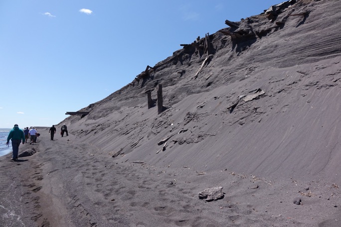
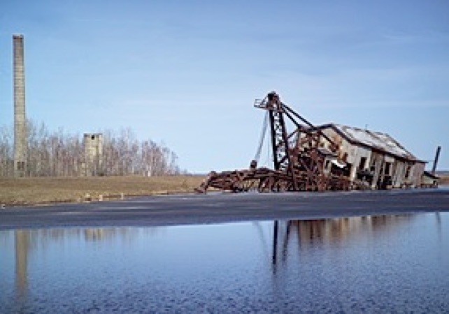
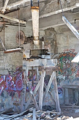
Eroded lake-facing cliff cut into the Gay Sands by Lake Superior wave action. Several sluices are exposed here, where stamp sand was carried by redirected water from the Tobacco River during milling activity at Gay. (photo by Steve Trynoski)

Mason