

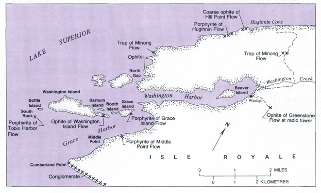
Washington Harbor
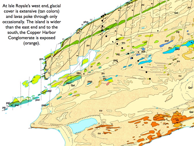
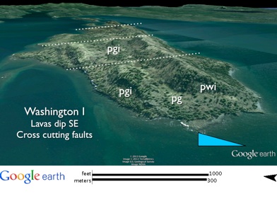
From Grand Portage, we will take the Voyageur E to Washington Harbor and Windigo about 35 km (22 mi) offshore. The bedrock geology of the Washington and Grace Harbor areas includes four large flows that continue all the way to the other end of the island. The Greenstone flow (pg) crosses the center of Washington Island and outcrops in several places SSE of Windigo. The Tobin Harbor flow (pth) outcrops at South Rock, SW of Washington Island. The Minong flow (pm) outcrops S of McGinty Cove, and the Scoville Point flow (psp) outcrops near Middle Point on the S side of Grace Harbor. The thickest flows in this area are the Washington Island flow (pwi) and the Grace Island flow (pgi). Both of these flows occur only locally, from the end of Washington Island to a point between Windigo and Sugar Mountain, a distance of about 14.5 km (9 rni) along strike. The lava flows here dip at 15-20° SE, an attitude that is similar for younger flows on Isle Royale. Vertical N-S trending fractures, with little offset, cut across the bedrock
strata near Washington Harbor. Huber (1983) interprets these as structures related to the warping of the Lake Superior Syncline. S of Grace Harbor, the bedrock of the island is buried by till.
The Isle Royale Fault
Between the Minnesota shoreline and Isle Royale,
the strike of Keweenawan rocks, known as the
North Shore Volcanics in Minnesota (1109-1100
Ma), changes from E-W to about N 55° E, where the PLV formation (1096-1094 Ma; Figure 13) at Isle Royale begins. This discontinuity could be partially related to the Isle Royale Fault, which the Voyageur crosses between Grand Portage and Isle Royale. This is a thrust fault, apparently associated
with the inversion of the Midcontinent rift and was
detected in the GLIMPCE profile collected on a NS
line E of the Keweenaw Peninsula . It is thought to extend W to at least the SW end of Isle Royale, where Isle Royale is mantled with a much thicker portion of glacial till and the glacial features are much more prominent (Huber 1983; see pp. 20-21 and 41-54).


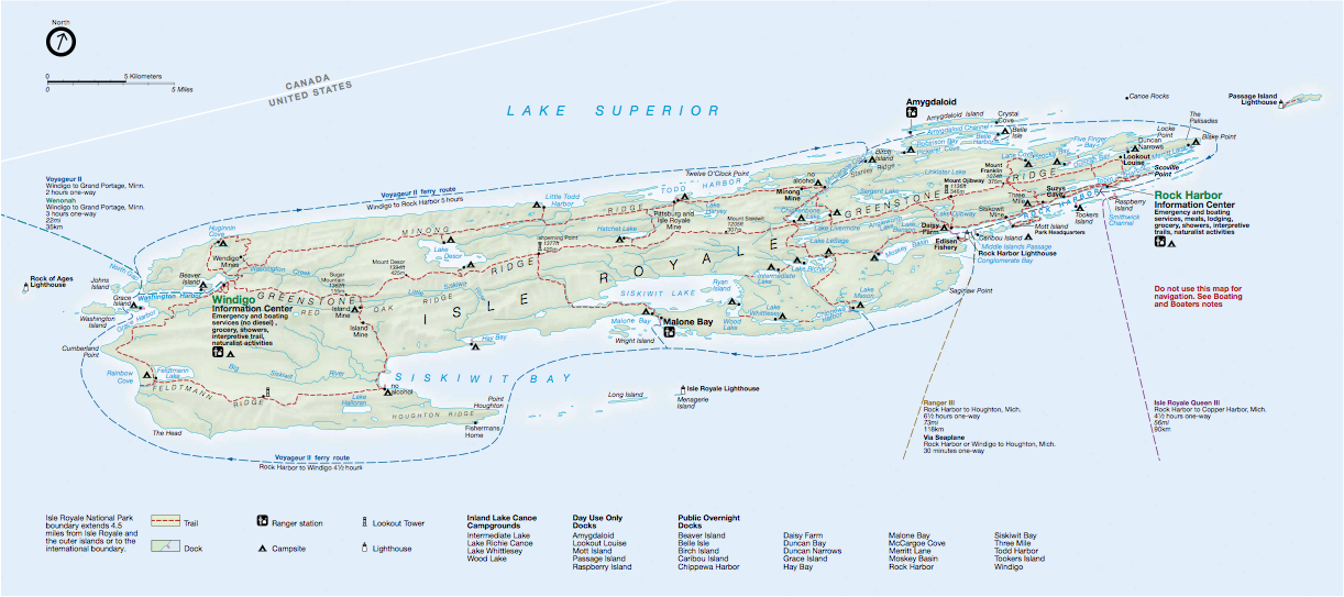
Windigo
The Windigo area was the site of the last serious mining on Isle Royale, from 1890 to 1892. After failure and closure of mines further E, the Wendigo Copper Company (renamed from the Isle Royale Land Corporation) founded a mining venture on 8000 acres of land at Washington Harbor, under the leadership of Jacob Houghton, who was the brother of Douglass Houghton. The town site was named Ghyllbank and was located near the present site known as Windigo. The mine site, about 2 km (1.25 mi) inland to the NE, was named Wendigo. People built roads all around the W end of Isle Royale, and 135 people lived at the mine site. The company did diamond drill exploration, as well as extensive trenching. In 1892, the miners gave up and left. When mining stopped, the company tried to sell land to tourists and resort owners (Rakestraw 1965).
Some outcrops to visit near Windigo (Huber, 1973)
Download .kmz files for Washington Harbor area.