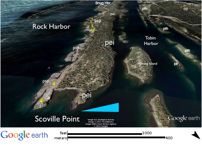
Scoville Point
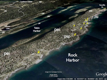
As we near the Scoville Point, the Scoville Point flow (psp) dominates the shoreline and has steep smooth exposures. At the point itself, we will look at the excellent exposures of the Scoville Point flow, the ophitic flows below it, and the Edwards Island flow (pei), which underlies the companion point located just to the NW of Scoville Point.
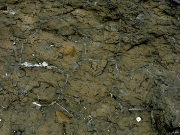
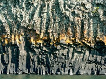
There is a good exposure of cellular amygdaloid in one of the ophitic flows and the Edwards Island flow shows well developed entablature jointing. We will return to the lodge and to Three Mile Campground via the Tobin Harbor Trail, which is easier to hike. It stays near the shore of Tobin Harbor, mostly atop the Edwards Island flow. Just NE of the Rock Harbor Lodge on the return trail is the site of the Smithwick Mine remains; this mine was discovered in 1843 and actually operated in 1847 and 1848. The work done here mostly consisted of exploratory shafts and excavations, and it is unclear whether or not much ore was found (Rakestraw, 1965).
For part of this day's trip we will walk on the rocky dip slope of the Scoville Point flow (psp), facing Rock Harbor along the shore. Huber (1973) describes the basalt of this flow as containing "fine, equant, millimeter sized, plagioclase crystals distributed uniformly through a fine grained matrix." He says the thickness is 30-60 m (l00-200 ft.). There are not many features that can be seen in outcrop, but the flow is very resistant to erosion and buttresses the shoreline. We will take the Stoll Trail, which goes along the shore of Rock Harbor. Along here, we will see 5000 year old Nipissing shorelines and glacially grooved outcrops of the Scoville Point flow. Outwash cover here is meager, but kettle lakes and morainal zones occur. On the map above, GPS markers identify the points of interest/inquiry. Also, we will be able to see the ophitic flows above and below the Scoville Point flow along the way. About 0.8 km (0.5 mi) from the Lodge lie ancient mine pits, attributed to Native Americans who occupied this area from about 2500 BC during the period of the Nipissing stage. The mining was apparently informal and quite limited in anyone place, but there are more than 1000 such pits all over Isle Royale according to Rakestraw (1965).
--While looking at the columnar joints in the Edwards Island flow (pei) at Scoville Point near the Dashler Cabin, we should discuss whether this jointing pattern is indeed entablature jointing in the sense of Long & Wood (1986) and whether we should infer that the Edwards Island flow was indeed cooled in part by being flooded by surface water (see also discussion here).