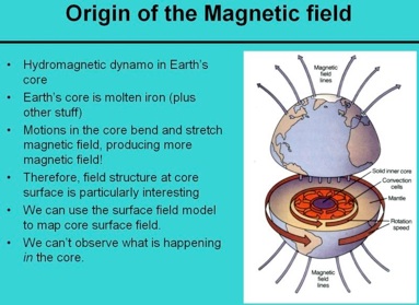
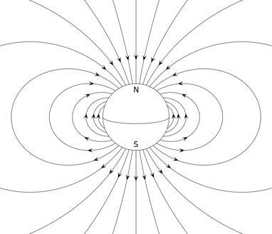
The record of the strength and direction of Earth’s magnetic field (paleomagnetism, or fossil magnetism) is an important source of our knowledge about the Earth’s evolution throughout the entire geological history. This record is preserved by many rocks from the time of their formation. The paleomagnetic data have played an instrumental role in deciphering the history of our planet including a decisive evidence for continental drift and global plate tectonics. The data have also been crucial for better understanding the problems of regional and local tectonics, geodynamics, and thermal history of our planet.
The paleomagnetism of rocks of the ~1.1 billion year old North American Midcontinent Rift have been intensively studied since early 1960s (for example, see a review in Halls and Pesonen, 1982). The rifting began during an interval of reversed polarity of geomagnetic field. The reversely magnetized lavas (the Siemens Creek formation of Powder Mill group, the lowermost part of North Shore volcanics, Osler volcanics, and the lower part of Mamainse Point formation) are found in many locations around Lake Superior (see figure from Nicholson et al., 1997, below).
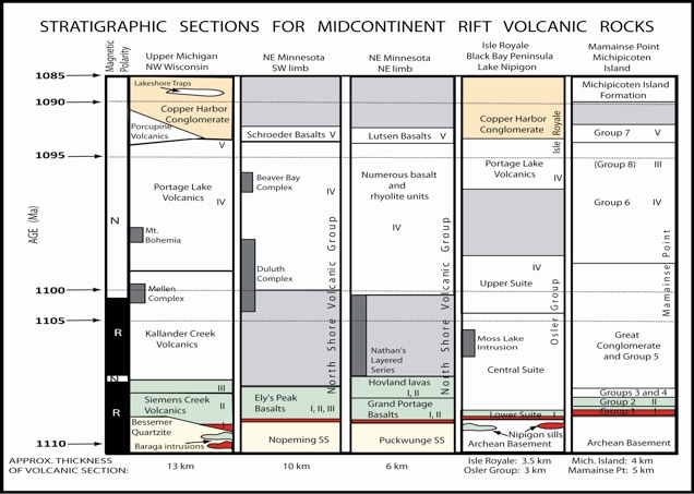
Magmatism renewed by 1102 Ma (Ojakangas et al., 2001) during the normal polarity interval. During this interval, a sequence of Portage Lake lava flows erupted within a two to three million year interval around 1095 million years ago. These rocks represent the main stage of the rift-related magmatism. All younger sedimentary and igneous suites exposed on the Keweenaw peninsula (the Copper Harbor conglomerate, LST, etc) have normal polarity magnetization.
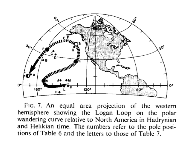
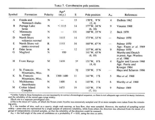
However, the geomagnetic field reversal mentioned above is characterized by an asymmetry, manifested in natural magnetization recorded by Keweenawan rocks that crop out around the Lake Superior (e.g., Palmer, 1970; Halls and Pesonen, 1982; Pesonen and Halls, 1983; Schmidt and Williams, 2003). Most but not all of the reversely magnetized (“reversed”) lava flows and dikes of this age consistently have characteristic directions of magnetization that are about 20 to 40 degrees steeper in inclination than their normally magnetized (“normal”) equivalents, while declinations show the expected 180 degree relationship. The paleomagnetic pole positions derived from these normally and reversely magnetized rocks define a noticeable amount of apparent polar wander that forms the western arm of the so called “Logan Loop” (Robertson & Fahrig, 1971) (see figure from Robertson & Fahrig, below).
The two most favored hypotheses for this reversal asymmetry are either apparent polar wander during Keweenawan times (Davis and Green, 1997; Schmidt and Williams, 2003) or the presence of a persistent non-dipole field causing the geomagnetic field to depart from a geocentric axial dipole geometry (Pesonen and Nevanlinna, 1981; Halls and Pesonen, 1982; Nevanlinna and Pesonen, 1983; Pesonen and Halls, 1983). The recent study of this problem (Swanson-Hysell et al., 2009) on lavas from Mamainse Point shows that the geomagnetic reversal asymmetry observed in rocks of Keweenawan age is an artifact of the rapid motion of North America during this time. The other study by Kern et al, (2012) on rocks of the alkaline Coldwell Complex (Ontario, Canada) also suggests no asymmetry in geomagnetic reversal during Keweenawan time.
(K Schulz, modified after Nicholson et al., 1997)
Wikipedia