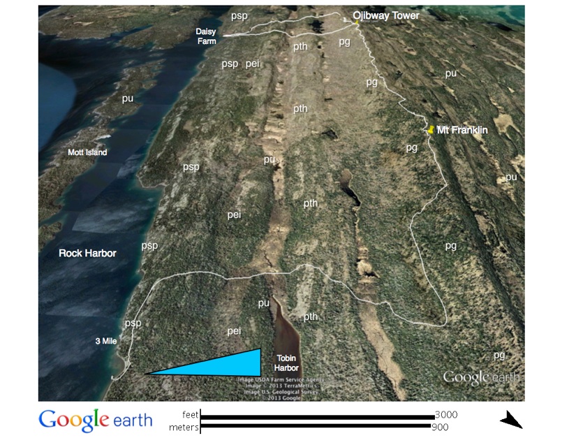
Mount Franklin
The Mount Franklin Trail begins 0.3 km (0.2 mi) W ofThree Mile Campground (see map). The trail immediately climbs a ridge supported by the Scoville Point flow (psp), then levels off and descends. We will cross a boardwalk over a swamp and arrive at a valley where there is a junction with the Tobin Harbor Trail, 0.8 km (0.5 mi) from Three Mile Campground. We will continue on the Mount Franklin Trail, straight ahead, crossing the Tobin Creek swamp and then climbing a ridge underlain by the Tobin Harbor flow (pth). From here we will descend to cross another swamp and then begin the 300 ft. ascent of the Greenstone ridge. The entire swamp and ascent is underlain by the great Greenstone flow (pg). At the top of the ridge there is a junction with the Greenstone Ridge Trail, which we will take left to go about 0.5 km (0.3 mi) to Mount Franklin, elevation 330 m (l080 ft.).
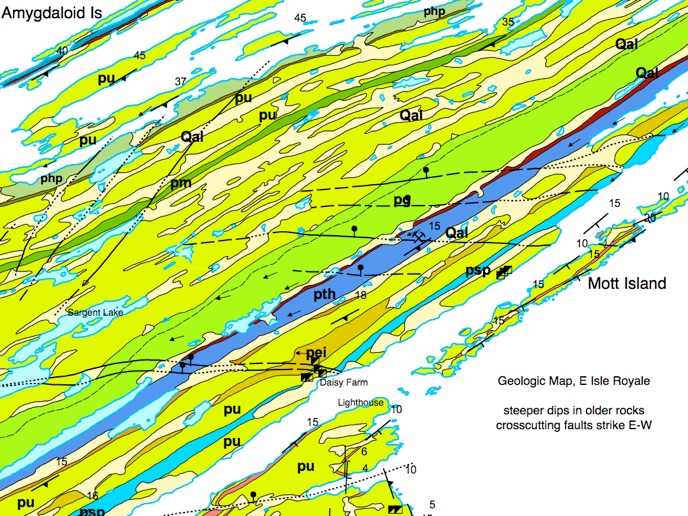
Here there is a good view of the N side of the island, including Five Finger Bay, Lane Cove, and Amygdaloid Island, as well as of the Canadian Shoreline, including the Logan Sills and the Sleeping Giant. The Greenstone flow is indeed the backbone of the island, forming the most prominent ridge all along; only at Blake Point, however, is a reasonably complete section through the flow exposed. The contact between the pegmatoid and the lower ophite units of the Greenstone is mainly located near the crest of the Greenstone ridge. The lower ophite underlies the N slope, which is a steep, anti-dip slope, and the pegmatoid armors the gentler dip slope to the S.
The Mount Ojibway Tower
Following the same trail, we will descend sharply to a wooded area and level off for about 0.4 km (0.25 mi) before climbing again. We will then reach the ridge crest and follow it for another 3.2 km (2 mi), with occasional outstanding views, to the Mount Ojibway tower. This structure was built in 1962 and was used initially as a fire tower. Now it is used for monitoring acid rain, along with other environmental monitoring. We can climb the tower stairs for full views of the surroundings, both to the N and S.
Daisy Farm Campground
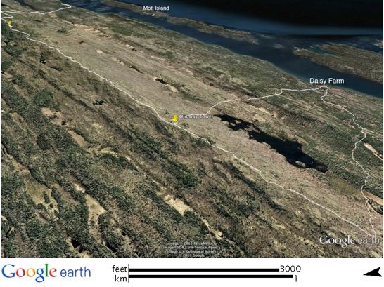
From the tower we will descend to the Daisy Farm Campground via the Mount Ojibway Trail. We will go down from the ridge to the first level spot and then begin to rise over a smaller ridge. The beginning of this small ridge is the approximate location of the top of the Greenstone flow; the ridge top and the dip slope to the S is underlain by the Tobin Harbor flow (pth). At the base of this ridge we will cross a swamp fed by Tobin Creek. Then we will ascend Ransom Hill, which has the Long Island flow (pli) on its anti-dip (N) side and the Edwards Island flow (pei) on its dip slope (S) side, where there is some entablature jointing. From Ransom Hill, the trail descends to Daisy Farm Campground.
Daisy Farm is located on the site of an old mining community, called Ransom, which was founded in 1847 with the clearing of land and the construction of a smelter. The mining prospects dimmed quickly, however, and the mining activity ended only two years later in 1849. Then, in 1866 all the buildings burned down. In later years, the place was the site of a sawmill, a garden that supplied vegetables to Rock Harbor Lodge, and a Civilian Conservation Corps (CCC) camp, which was a foundation for youth employment, developed by Roosevelt during the depression (Rakestraw 1965).