NW Coast
 

The N Side of Isle Royale: The Hill Point Flow

After Windigo, we travel along a straight section of the coast which follows the Hill Point Flow. Muted by glacial deposits, the layered strata of lava flows shows in the geomorphology. Note the cross cutting faults (dotted lines in Google Earth views) which are conspicuous in this area. These faults may have formed during deformation of the rift during its subsidence and during the Grenville Orogeny. The faults may have enhanced fluid flow, zeolite facies metamorphism and copper mineralization. The faulted Windigo area is one place where some mining occurred.

The shoreline is steep and straight for more than 10 km, following the Hill Point Flow. The faults shift gradually from nearly N trending toward the NE as we move eastward.

NW Coast

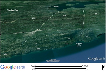
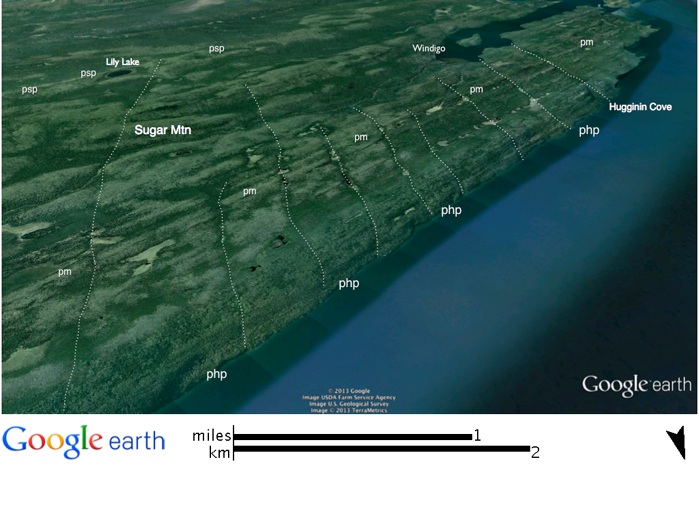
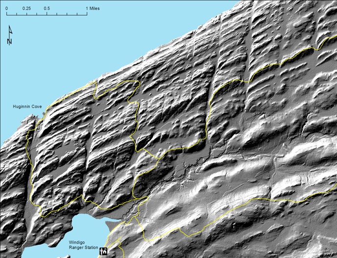
With the flows dipping SE, moving toward the N side of the island takes us further into the PLV section, until we reach the horizon of the Hill Point flow (php). This is an ophitic flow, which forms imposing cliffs along the shore from Hugginin Cove all the way to Todd Harbor,

a distance of about 24 km (15 mi). This flow also makes up the majority of shoreline from Pickerel Cove all the way to Hill Point itself, at the W end of Five Finger Bay, about 64 km (40 mi) from Windigo. The tilted strata along the shore make the shoreline steep, and the prevailing winds from the NNW can make conditions treacherous

for small boats.

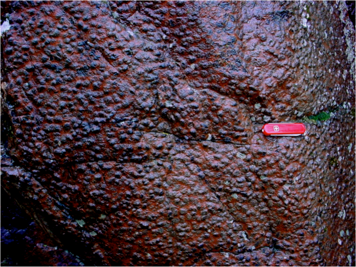
The Hill Point flow is a coarse-grained, ophitic

unit with augite oikocrysts of 2 cm (0.8 in) or more. The vertical fractures are superimposed across the dipping strata and are noticeable throughout the entire flow. From the W area of the flow to the E area, the fractures gradually begin to change from N-S to more N-E trending. According to Longo (1984), the Hill Point flow may correlate with a large flow on the Keweenaw Peninsula, the Scales Creek ophite, which extends all along the Keweenaw Peninsula for more than 160km (100 mi) of strike length, and right through Houghton, which is about 110km (68 mi) SSE of Hugginin Cove.

LIDAR survey of all of Isle Royale, with a nominal resolution of about 2 m is newly available for study. The image above came from Seth De Pasqual, at Isle Royale National Park. It reveals a striking topography which shows the dipping lava beds, and the prominent large lava flows, like the Hill Point Flow (php) and the Minong flow (pm) in this image of the region NE of Windigo. Differential erosion of lava flows occurs when soft material, like what is found in the amygdaloidal flow tops and along faults is preferentially removed and makes a topographic low, while the massive flow interiors resist erosion and become topographic highs. The prominent N-S faulting of the lava layers is obvious, as are less extensively altered NE trending faults.  Glacial deposits mask the lava layers in part, especially southward in the image, where the Grace Island (pgi) and Greenstone flows (pg) are mostly covered, but protrude through glacial cover.

Trails are plotted in yellow.  This LIDAR data is advantageous for structural geology study because of its sensitivity to faults.  It also reveals details of glacial (drumlins, outwash, kames, etc) and postglacial features (shorelines, mine pits, dumps and roads).

pm
pm
pm
pm
pgi
pgi
pg
pg

Seth De Pasqual, NPS 2013

php

php

php