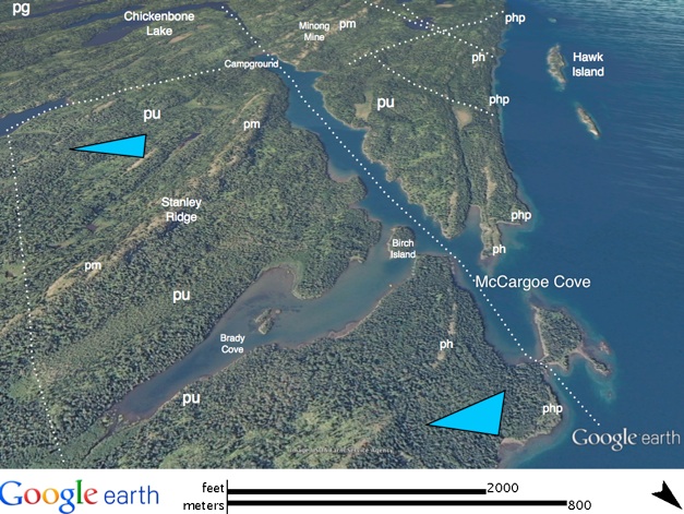
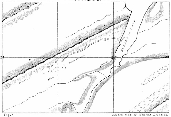
McCargoe Cove
At the midpoint of the island is McCargoe Cove, which is a fiord-like, 3.2 km (2 mi)
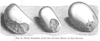
long inlet that follows a large fracture zone, trending N 30· E to a campground site located along an ancient Native American portage route and near another mine, the Minong Mine. Native Americans left hundreds of ancient pits as relics of mining from 6500 to about 5400 yrs BP. In 1874 three companies were formed in Detroit to exploit the potential here. They built a dock and a warehouse and started to build a railroad. Some large masses of copper were
successfully mined, and the community here grew for several years in spite of difficult winter conditions. But mining did not last beyond 1885 (Rakestraw 1965).
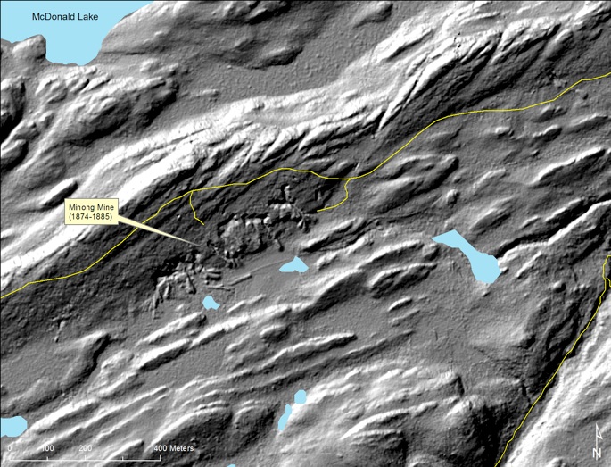
LIDAR survey of all of Isle Royale, with a nominal resolution of about 2 m is newly available for study. The image above came from Seth De Pasqual, at Isle Royale National Park. It reveals a striking topography which shows the dipping lava beds, and the prominent large lava flows, like the the Minong flow (pm) in this image of the region W of the McCargoe Campground. Differential erosion of lava flows occurs when soft material, like what is found in the amygdaloidal flow tops and along faults is preferentially removed and makes a topographic low, while the massive flow interiors resist erosion and become topographic highs. The prominent NE trending faulting of the lava layers is obvious. In this image the mine pits and dumps associated with the Minong Mine are easily resolved, which shows how LIDAR can map topographic features which are difficult to resolve through vegetative cover. The relationship of copper mineralization occurring in the area above a thick lava flow is common, perhaps due to the effect of channeling fluid, as the flow interiors are relatively impermable and act as a hydrologic dam.
Trails are plotted in yellow. This LIDAR data is advantageous for structural geology study because of its sensitivity to faults. It also reveals details of glacial (drumlins, outwash, kames, etc) and postglacial features (shorelines, mine pits, dumps and roads).