Calumet Grooves
Grooves with additional Information!

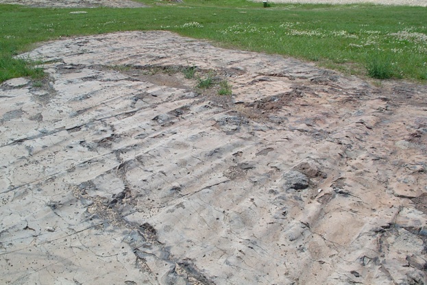
Glaciers leave tracks in the rock surface that they move over. In the Keweenaw, grooves are found on many rock surfaces and these show that glaciers moved across the Keweenaw in a direction that generally trends NE to SW. In one place, on the Calumet High School grounds, it is possible to infer from the rocks that ice moved from NE to SW. Examples from other places here.
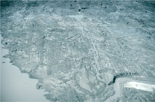
August 1996 north-looking oblique aerial photograph of a recently-exposed area adjacent to the terminus of the Bering Glacier, the largest Alaskan glacier, located east of Cordova. Features present include numerous parallel glacial grooves and furrows, several eskers, and several recessional moraines. The debris-covered glacier terminus is at the top edge of the photograph. From left to right, the field of view is ~ 1.5 miles across. Bering Glacier flows through Wrangell-Saint Elias National Park. Chugach Mountains, Alaska.
USGS
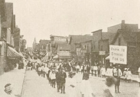
Calumet is famous, especially for mining and labor issues--we visited one especially famous site at the ruins of Italian Hall:
The story of the Italian Hall event
Big Annie Clemenc, heroine of Calumet
The outcrop above exposes a lava flow that is right below the C&H Conglomerate on the school grounds. The flow contains vesicle cylinders in which the vesicles are filled with quartz, a very hard mineral. When the glacier slid across this outcrop, the quartz resisted much more than the rest of the rock so the vesicle cylinders now protrude from the rock, and ridges of the basalt persist behind these bumps. This is why we can infer an ice direction movement. Detailed view is below (Karl Larson).

Ice Moved this way
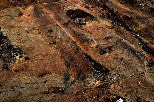
Karl Larson