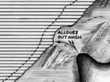
Allouez Gap Outwash
Allouez Gap Outwash

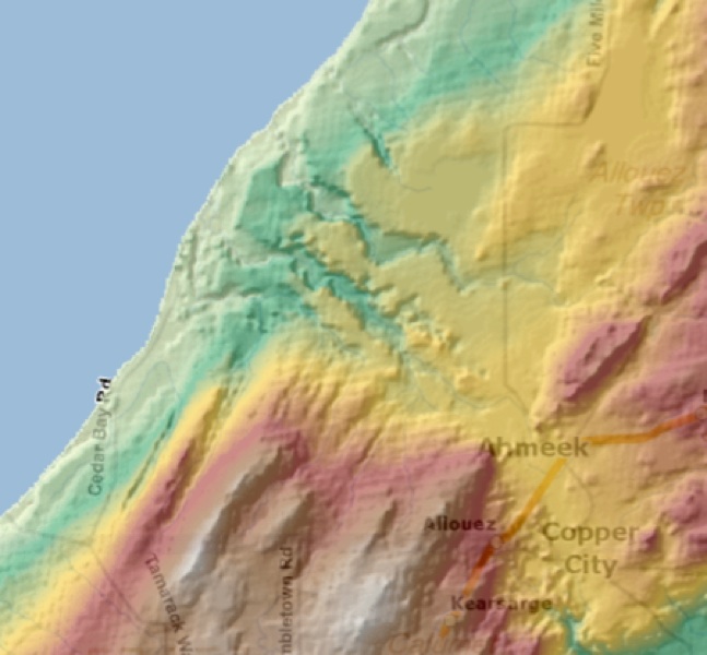
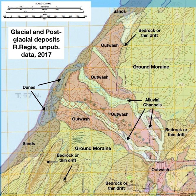
The Gap funneled outwash to the NW from moraines which are left barren as bedrock along the Greenstone ridge. The outwash occurred during glacial melting, forming a fan of outwash sloping toward a high lake called Lake Duluth. Continuing glacial melting formed alluvial channels along the present day streams of Gratiot River, Hills Creek and Piney Creek. These three modern streams are small compared to their valleys. Hills Creek has been used as a transporter of stamp sands from the Allouez Mines and sands from mills fills and clogs the stream and the area around the river mouth. Along the Lake Superior shoreline are remnants of shorelines created during the existence of many post glacial lakes, including Lake Minong (~9000 yes ago) at a level of about 690 ft (90 ft higher than the current lake level. Below the Minong shoreline are sandy sediments and dunes. This is a prime spot to observe glacial and post-glacial features
Narrows of the Allouez Gap

First Channel
Second Channel
Dunes
Kettles
The Narrows of the Allouez Gap mark the lowest elevation of Keweenaw Crossing between the Keweenaw Point and inland, except for the Keweenaw Waterway. The Gap channelled glacial materials carried downstream by the large discharge rates that affected the outflow during glacial melt periods. So now the rivers here are underfit streams, trickles of their former selves.

Kettles