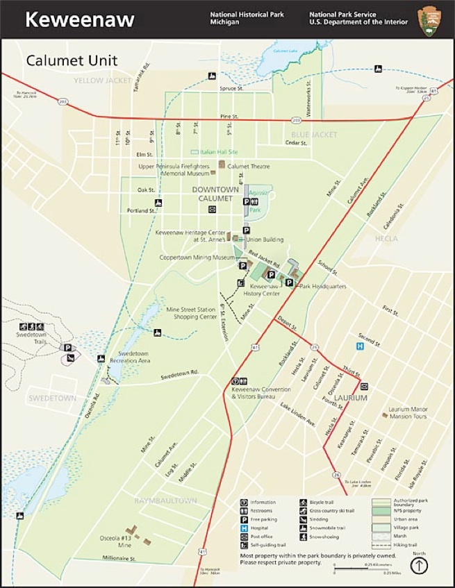
The mineralized conglomerate was a layer which ranged for several to more than 25 feet in thickness and was aligned with Mine Street, where many shafts were sunk. In Calumet there are two locations that the C & H Conglomerate location can be easily identified. It has an outcrop near the end of Millionaire Street at the southern edge of the Township. And the Calumet #3 shaft opening, in the school playground also marks the surface projection. Next to the shaft a boulder has been located.


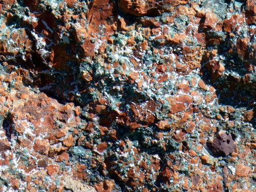
The C & H Conglomerate contains copper that has filled open spaces between pebbles and boulders. The copper projects from the rock, so you can feel its rough edges. It is corroded to a greenish color. This piece of Conglomerate has several % of Copper.
C & H Congl


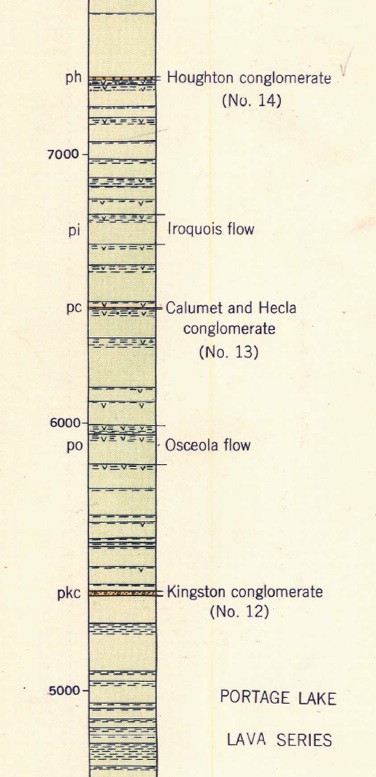
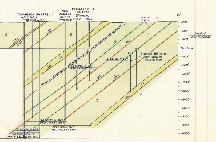
The C & H Conglomerate is a 25 ft thick layer which is the host rock for the copper mined along the black line above and its projection underneath Red Jacket (downtown Calumet). It is found within a sequence of 287 lava flows at the level indicated by the oval below.
The C & H Conglomerate dips down at about 38 degrees toward Lake Superior and Isle Royale, underneath Red Jacket. The deepest parts of the mine are thousands of feet below sea level.
This is a cross section of the sequence of layers, mostly lava flows (there are 287 lava flows in the whole section at Calumet!). The conglomerates are important to the copper deposits as they typically can be mineralized with copper.
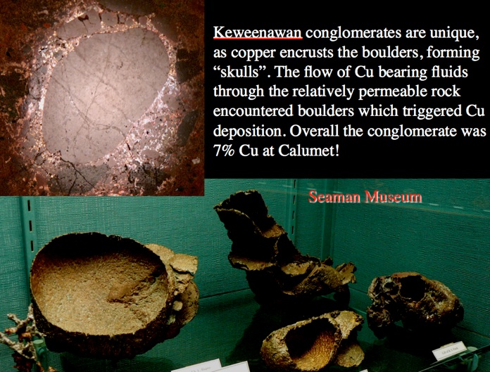
The conglomerates were numbered from bottom to top so that they could be correlated from place to place. #13 was a lucky number-- It contained up to 7 % native copper. It marked the C & H Conglomerate (up to 25 ft thick) which was the richest of all and the most consistent. It was mined to great depth and left a huge mined out area underneath Red Jacket. The shafts that cross through along Mine Street in Calumet, behind the High School and on to Osceola and beyond mark the trace of this conglomerate.
C & H Conglomerate


“The greatest copper mine in the Copper Country was born from pure happenstance. While surveying the military road running between Fort Wilkins at Copper Harbor and Fort Atkinson in central Wisconsin in 1864, Edwin J Hulbert stumbled across a peculiar find. It was an ancient Indian storage pit, left by native miners. The pit was filled to the brim with a copper rich boulders, and prompted Hulbert to secure the land around it. Purely by chance, those ancient miners placed their copper storage pit directly atop the great Calumet Conglomerate lode, which it didn’t take Hulbert long to discover. The Calumet Mine was born.
Just to the south of the Calumet Mine a second mine opened on the same lode – the Hecla Mine. The lode proved just as productive as the Calumet to the north, and soon the two mines (along with two other minor mines) combined to form the Calumet and Hecla Mining Company. Though now one mine, the two parts of C&H regained their original identity. North of Red Jacket Road were shafts of the old Calumet Mine (labeled Calumet #1-5), and south of the road sat the shafts of the old Hecla Mine (labeled Hecla #1-8).”